
01
The criteria sit on different layers
Slope, constraints, grid: each piece of information comes from a different source and has to be cross-checked by hand in GIS.
HOW IT IS TODAY
01
Slope, constraints, grid: each piece of information comes from a different source and has to be cross-checked by hand in GIS.
02
Suitable areas have no single definition: each territory has its own criteria and exclusions.
03
A perfect site 14 km from the primary substation is not a site, and you only find out at an advanced stage of assessment.
HOW IT CHANGES WITH LANDSCORE
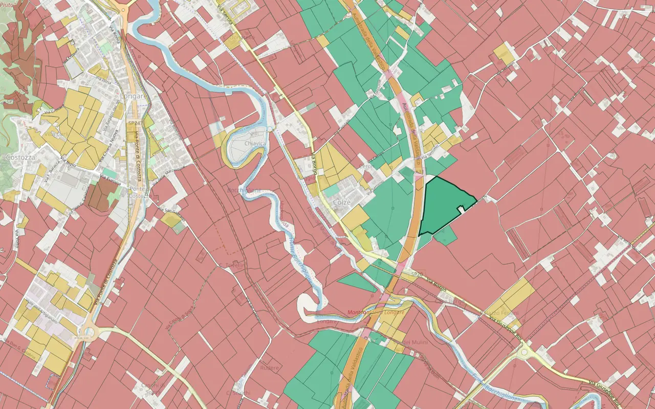
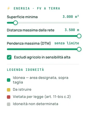
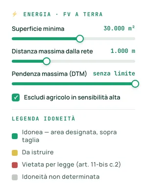
Minimum area, slope, plot shape and land use: the platform returns the parcels that meet them.
See the search features →Protected areas, Natura 2000 and landscape cross-checked on the parcel and declared one by one; landslides and floods as a percentage of the plot (ISPRA).
See risks and constraints →Distance from the grid among the criteria of the very first search; in the plant dossier, the nearest primary substation and Terna station, as the crow flies.
See the search features →Each parcel or plot on the shortlist can be exported, one at a time, to GeoJSON or KMZ; the map also to DXF, in real coordinates (UTM, RDN2008); with the Team plan, also via API into your own tools.
See dossiers and integrations →A REAL CASE
From a regional boundary to a shortlist of areas to present to the technical committee.
PHASE 01
Area ≥ 5 ha, slope < 5%, distance from the grid < 3 km, suitable areas under art. 11-bis.
PHASE 02
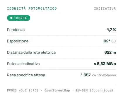
The suitable parcels are ranked, with slope, expected yield and distance from the grid.
PHASE 03
National protections cross-checked on the parcel and declared one by one, with the source stated; landslides and floods as a percentage of the plot; nearby, the ground-mounted photovoltaic plants already built (ISPRA), as context: they do not make the land suitable.
PHASE 04
The dossier for each parcel, and the plot in CSV, GeoJSON or KMZ, ready for the technical committee.
OBJECTIONS
Suitability follows the national rule, art. 11-bis of Legislative Decree 190/2024; you set area, slope and distance from the grid. Any additional regional rules must be checked separately.
Distance from the grid is a search filter, not a later check. The plant dossier also includes the nearest primary substation and Terna station, the saturation of e-Distribuzione substations and the connection requests to Terna in the municipality: distances as the crow flies, not a quote.
With the ban on agricultural land in art. 11-bis para. 2 and the exclusion of agricultural land with high landscape sensitivity, declared one by one in the dossier.
OTHER LINES OF WORK
Whoever signs off the project works on the same constraints and the same rules.
See the page →Whoever finances the deal assesses the same areas with the same criteria.
See the page →Read next: Suitable areas for photovoltaics: how to narrow the field →
A 20-minute call about your work, with a real plot.