
Developers, asset managers and funds
- Opportunity scouting with criteria-based filters
- Comparative portfolio analysis and site ranking
- Development capacity and plot value
Designed for developers and funds, surveyors and architects, estate agencies, energy, banks and valuers, non-performing loans and auctions, data centres.
Anyone who works with land starts from the same question: what can I do with it? LandScore answers it, for each of them.
In Italian, as you would to a colleague.
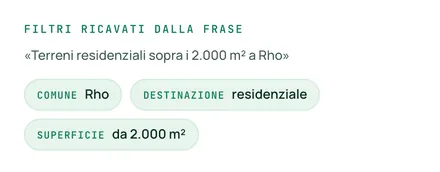
“Residential land over 2,000 m² in Rho.”
It turns the sentence into filters and applies them to every parcel in the municipality, cross-referencing land registry, zoning and market data.
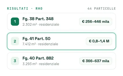
The best parcels, ranked, with the explained parcel sheet and the dossier ready.
From weeks to minutes. From a subjective opinion to an explainable, traceable analysis — one that even a bank can trust.
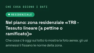
The plan's implementation rules come as PDFs hundreds of pages long. LandScore links them to the parcel's zoning district and answers by citing the article.
See all features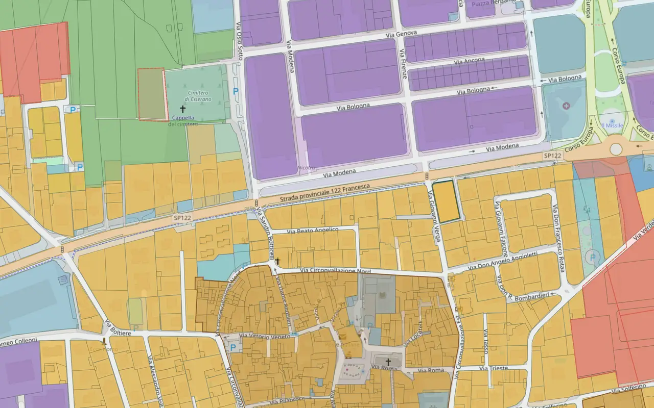 Fg. 5 Part. 1595 · Ciserano · 1,980 m²
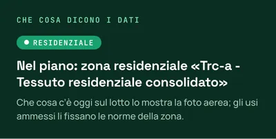

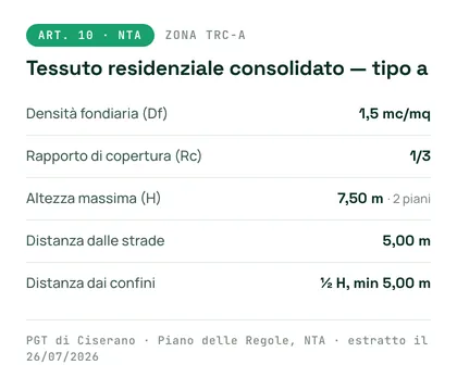

Platform screenshots · Ciserano (BG), Fg. 5 Part. 1595 · October 2026 · base map © OpenStreetMap
Free trial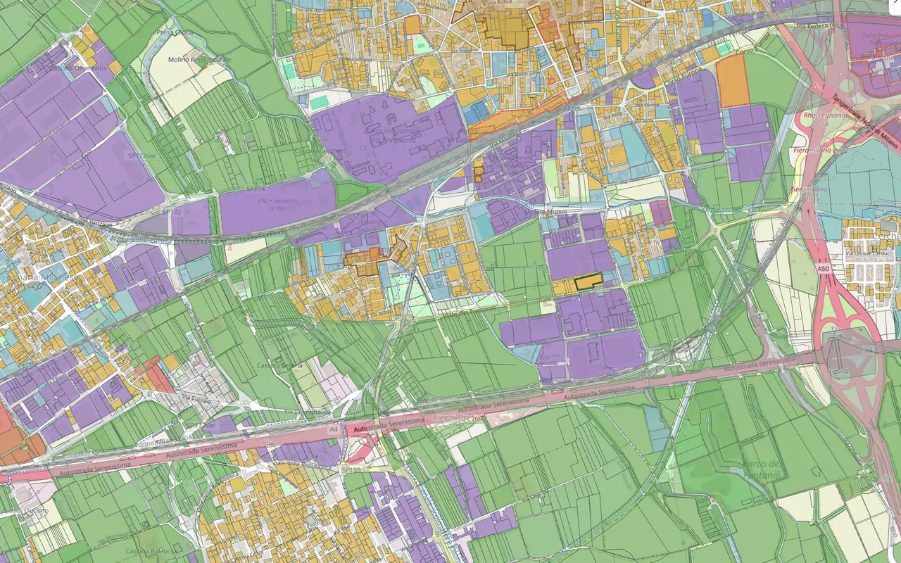









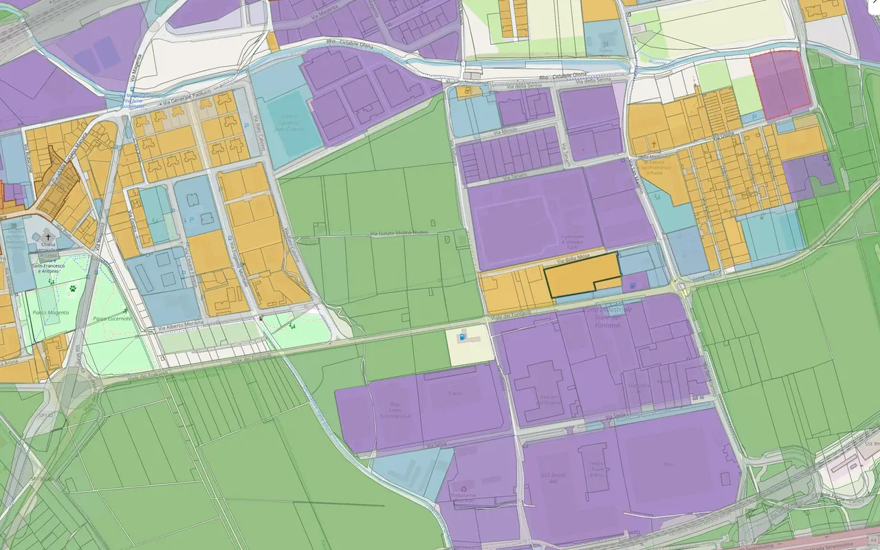
Platform screenshots · Rho (MI) · October 2026 · base map © OpenStreetMap
Free trialMunicipality, land use, area, budget: write them as you would say them to a colleague. LandScore recognises the criteria, shows them to you one by one and finds the parcels that meet them, ranked from the best fit.
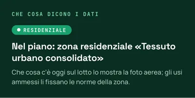
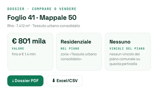
See all featuresThe parcel sheet tells you what the plan provides for, which constraints apply and what the land is worth: every item with its source and date. The dossier exports in one click.
See all features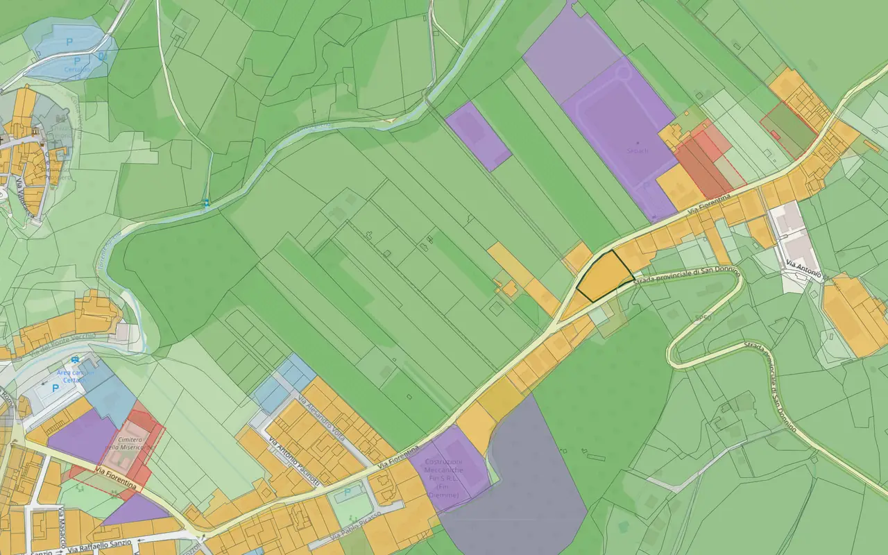

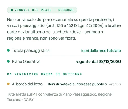
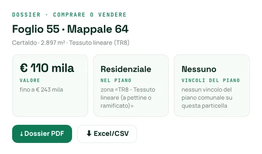
Platform screenshots · Certaldo (FI), Fg. 55 Part. 64 · October 2026 · base map © OpenStreetMap
Free trialWrite your criteria in a sentence: LandScore turns them into filters and finds the parcels that meet them.
Combinable filters on size, shape, slope, zoning district and values.
Zoning rules extracted from the plan PDFs and made queryable, municipality by municipality: no leafing through documents.
Density index, maximum height, site coverage ratio and distances, zone by zone, where the rules have already been read.
Zoning index × plot area, with the permitted heights and site coverage.
Protected areas, Natura 2000, landscape (state constraints), areas for renewables and municipal plan constraints. Landslides and floods as a percentage of the plot, the municipality's seismic zone, buffer zones along roads, railways and watercourses. Other constraints are flagged as to be verified.
From the parcel sheet, you ask the Agenzia delle Entrate who owns the parcel, pay-per-use (being activated). Public ownership is already shown, where it appears in MEF data.
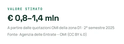
Property values on the map, from OMI property values.
A value range from OMI property values, with the source and the calculation shown in full.
The dossier follows the purpose you choose (buying or selling, loan assessment, project, solar PV, quick check), with sources and dates, the parcel map and your firm's name on the dossier (Studio plan): print it or save it as PDF.
Ask “what does the plan provide for here?”, “what is it worth?”, “what constraints apply?”: it answers from the data of the parcel you are looking at.
Your own AI (Claude, ChatGPT, Copilot) queries the platform with your API key, on request.
Save a search, rerun it with one click and see what has changed: the new parcels and those that dropped out.
From the first screening to the negotiation, with notes and deadlines. Updates on Slack, emails ready to send and files to import into your CRM.
Quick answers about LandScore: the data, how it reads a parcel and who it is designed for.
Can't find the answer? Write to us →
A platform that finds and assesses land in Italy starting from public data. Describe in words what you are looking for: LandScore cross-references the land registry, zoning and market data on every parcel and returns the best ones, ranked, with the explained parcel sheet and the dossier ready.
Land registry data, zoning data (municipal PGT and PRG plans), territorial and environmental constraints, landslides and floods (ISPRA), seismic zone (Protezione Civile), market values (OMI) and the power grid (OpenStreetMap, Terna, e-Distribuzione): all from public sources, with source and date tracked.
It turns weeks of technical analysis into a few minutes: criteria written in a sentence become filters, development capacity, constraints and values; the dossier downloads as a PDF, the parcel or plot data as CSV, GeoJSON or KMZ.
The parcel sheet tells you what the plan provides for, which constraints apply and what the land is worth: every item with its source and date — no black box.
Developers, asset managers and funds; architects and surveyors; estate agencies; energy operators; banks and valuers via API; those managing non-performing loans and auctions; those looking for data centre sites.
Geoportals give you raw data to look up, a map — not a criteria-based search. Valuation software values a single property for banks and valuers — a different job from scouting. LandScore answers “what the plan provides for on this land, with which constraints and which zone values”, with an analysis you can follow step by step.
Not yet: coverage is growing municipality by municipality. On the platform, the coverage map shows for each municipality whether the land registry parcels are there, whether the official plan has been loaded and whether the technical rules have already been read. To find out whether your municipality is covered, look it up in “Find your municipality” (landscore.it/copertura).
The databases are periodically realigned with official publications (land registry, OMI, zoning plans). Every data point shows its source and update date, visible on the platform and in the dossier: you always know what you are basing your decision on.
No. LandScore runs in your browser, with nothing to install. You can start from the guided filters or describe in words what you are looking for; the result is a clear dossier, ready to share even with people who never open a GIS.
No: it is not a marketplace and does not act as an intermediary. It finds and assesses parcels — including those not for sale, off-market — and gives you what you need to decide; contact and negotiation remain yours.
Until recently the information existed, but it was scattered, paid for and locked in PDFs. In eighteen months everything has changed.
Consulting the land registry data of your own property becomes free for the owner.
Cadastral mapping is published as open data under a CC BY 4.0 licence: commercial reuse included.
More and more municipalities publish plans and rules in digital, georeferenced format, using shared standards.
Under the PNRR, municipal building permit offices are being connected to one another and to national systems.
The raw material has just become free, digital and standard. LandScore is the engine that makes it useful.
7 days in the real platform, on a municipality you choose. No charge during the trial.