
01
Scouting is done by hand
Weeks spent on portals, plan PDFs and phone calls to work out whether a site is worth it. The best opportunities go to whoever gets there first.
HOW IT IS TODAY
01
Weeks spent on portals, plan PDFs and phone calls to work out whether a site is worth it. The best opportunities go to whoever gets there first.
02
Every analyst has their own spreadsheet: different criteria, results that cannot be lined up, know-how that leaves with the people.
03
Cited sources and verifiable numbers: assembling each investment dossier by hand costs days of skilled work.
HOW IT CHANGES WITH LANDSCORE
You set the land use, minimum size and zones: the platform reviews the parcels and discards those outside the criteria.
See the search features →Every site has the same parcel sheet: what the plan provides for, what constraints apply and what it is worth, each item with its source and date.
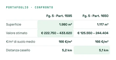
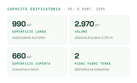
How we read a parcel →Development capacity and a value range from OMI property values, in the same place where you found the land.
See the plot value →Zone, rules, constraints and accessibility, with sources and dates, in a PDF set up for design and construction.
See dossiers and integrations →A REAL CASE
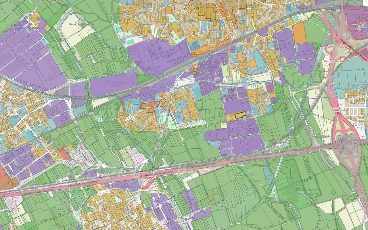
How you get from an investment strategy to three sites to take to committee.
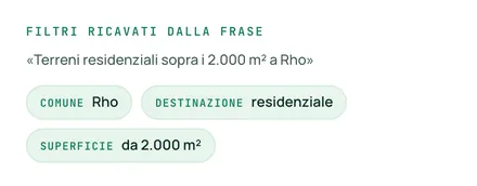
PHASE 01
Residential, minimum size 5,000 m², municipality by municipality across the northern ring of Milan.
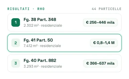
PHASE 02
The parcels that meet the criteria are ranked, starting from the best fit.
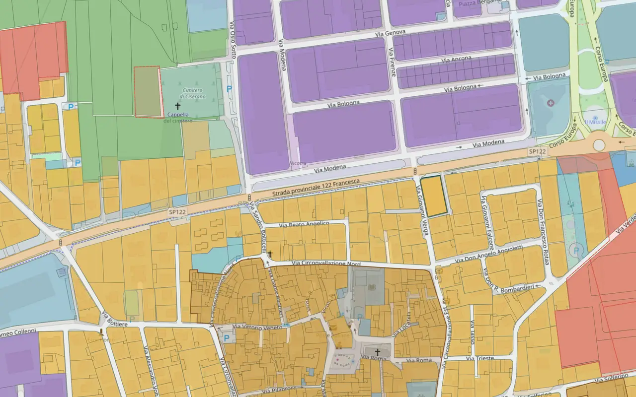
PHASE 03
For each one: plan zone and rule article, development capacity, constraints declared with their source.
PHASE 04
Three dossiers set up for design and construction: zone, rules, constraints, accessibility and the zoning use certificate (CDU) in an informational version, with sources cited one by one.
OBJECTIONS
A GIS draws; it does not search parcels by criteria or read the plan's rules. LandScore sits upstream of it: the parcel or plot you choose can be exported to GeoJSON or KMZ, and the map to DXF with real coordinates.
Every data item carries its source and update date, visible in the platform and in the dossier: you decide knowing what you are deciding on.
We do not buy lists. We start from parcels, not listings: most of the land that can be analysed is not for sale.
OTHER LINES OF WORK
Whoever brings you opportunities works on the same data, with a dossier that speaks to the seller.
See the page →Whoever builds checks readiness for construction and constraints on the same parcels.
See the page →Read next: Land due diligence: the sequence of checks →
A 20-minute call about your work, with a real plot.